


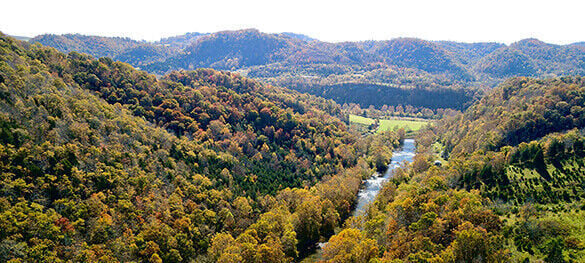
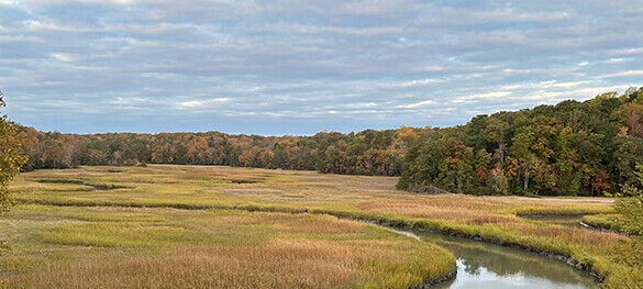
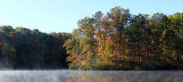


There’s nothing quite like fall at Virginia State Parks. From the mountains to the coast, the changing leaves create a beautiful backdrop for going to a fall festival, relaxing by a campfire or connecting with nature on a trail.
Our state parks experience peak fall colors at different times, so check out our fall foliage report and refer to this list for recommendations on when and where to best view fall foliage at each park below, separated by region: mountain, central and coastal. Plan your fall getaway today.
Please note: Generally, peak fall foliage is sometime between October 10 and 31, but these dates can change from year to year. Click here to learn more.
People are also reading…
Mountain peak fall foliage: Early October
- The gazebo behind Howe House.
- Lakeview Trail: 0.95, rated easy.
- Sugar Hill Loop Trail: 3.3 miles, rated moderate.
- Riverside Trail: 1.9 miles, rated easy.
- Tuscarora Overlook: Can be reached via Stony Run or Blue Suck Falls trails, both rated difficult.
- The deck at the Lakeview Camp Store & Grill.
- Upper Stuart’s Knob Trail: three-quarters of a mile, rated difficult.
- The beach.
- Twin Pinnacles Trail: 1.3 miles, rated moderate.
- Buzzard Rock Overlook.
- Eagle's Rest Trail: 1.2 miles, rated moderate.
- Visitor center porch.
- Molly’s Knob Trail: 1.9 miles, rated difficult.
- The beach.
- The gazebo: Requires a 0.37-mile walk. Guests with limited mobility can contact the park for permission to drive to the gazebo.
- Main overlook behind the visitor center.
- Hiwassee Trestle (P10).
- Foster Falls (P24).
- The Victorian Garden.
- Martin’s Station.
- Indian Ridge Trail: 0.77 miles, rated moderate.
Central peak fall foliage: Mid-October
- Channel Cat Loop: 1.8 miles, rated moderate.
- Otter Trail: 0.2 miles, rated easy.
- Buford's Knoll: 2.52 miles.
- Fleetwood Hill: 0.26 miles.
- Smyth Trail: 1.9 miles, crosses scenic High Bridge.
- Camp Paradise Trail: 1 mile, rated moderate.
- Northridge Trail: 0.4 miles, rated moderate.
- Lakeshore Trail: 6.5 miles, rated difficult.
- Tye River Overlook: Can be accessed by hiking Cabell Trail. Guests with limited mobility can contact the park for permission to drive to the Tye River Overlook.
- Taylor Trail & Taylor Pond Loop: 1 mile, rated moderate.
- Railroad Forrest Trail: 1.4 miles, rated easy.
- Big Woods Trail: 1.2 miles, rated moderate.
- Skyline Trail: 0.6 miles, rated easy.
- The Natural Bridge.
- Mossey Creek Nature Trail: 0.7 miles, rated easy.
- Amphitheater.
- Beaver Lake Trail: 2.5 miles, rated moderate.
- Spillway (paved) Trail: 0.2 miles, rated easy.
- Turkey Trail: 1.2 miles, rated easy.
- Coyote Run Trail: 0.3 miles, rated moderate.
- Culler’s Overlook.
- Redtail Ridge Trail: 1 mile, rated easy.
- Battlefield Trail: 1.24 miles, rated easy.
- Edgewood Nature Trail: 0.7 miles, rated easy.
- Custis Lee Trail: 0.8 miles, rated moderate.
- Wheaton Trail: 0.7 miles, rated easy.
- Gokotta Trail: 0.8 miles, rated easy.
- River’s Way Natural Play Space.
- Piedmont Overlook Trail: 0.61 miles, rated moderate.
- Turner Pond.
- Turtle Islands Trail: 1.4 miles, rated moderate.
- Discovery Center.
- River Bank Trail: 8.5 miles total but has several access points to create shorter hikes, rated moderate.
- Amphitheater.
- Legacy Loop Trail: 4 miles, rated moderate.
- Farmstead Loop and Piney Run Spur Trail: 2 miles, rated moderate due to elevation changes, but good for all ages and all fitness levels.
- Otter’s Path Trail: 2.9 miles, rated moderate.
- Goodwin Lake Trail: 1.1 miles, rated easy.
Coastal peak fall foliage: Mid-to-late October
- Porpoise Creek Trail: 0.38 miles, rated easy.
- Mulberry Creek Boardwalk: 0.17 miles.
- Potomac Overlook Trail: 0.94 miles, rated easy.
- Poplar Grove Trail: 0.7 miles, rated moderate.
- Equestrian Trail: 8.3 miles, rated easy.
- College Run Trail: 1.2 miles, rated easy.
- Sand Ridge Trail: 6.4 miles, rated moderate.
- Maple Leaf Trail: 0.67 miles, rated easy.
- Bald Cypress Trail: 1.8 miles, rated moderate.
- Live Oak Trail: 0.4 miles, rated easy.
- Brown Pelican Trail: 0.57 miles, rated easy.
- Raptor Trail: 1.51 miles, rated easy.
- Lee’s Woods Trail: 1.96 miles, rated moderate.
- Potomac Trail: 0.41 miles, rated easy.
- Interpretive Trail: 0.07 miles, rated easy.
- Forestry Trail: 2.4 miles, rated easy.
- Eagle Spur Trail: 1.29 miles, rated moderate.
- Bay View Trail: 1.02 miles, rated easy.
- Conservation Corps Fitness Trail: 1.6 miles, rated easy.
- Big Meadow Trail: 0.6 miles, rated easy.
- Holly Marsh Trail: 0.05 miles, rated easy.
- Long Pond Trail: 1.75 miles, rated easy.
- Taskinas Creek Trail: 2 miles, rated moderate.
- Woodstock Pond Trail: 0.85 miles, rated easy.
You can learn more about these parks and the activities they offer at www.virginiastateparks.gov. To find cabin, yurt or campground availability, please go to www.reservevaparks.com/Web.


